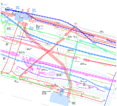
A utility map shows the positioning and identification of buried pipes and cables beneath the ground. The procedure involves detecting things like sewers, electric cables, telecoms cables, gas and water mains. Combine this mapping process with a topographical survey and the results will provide you with a comprehensive detailed map of anything that is hidden underground or directly related to any above ground features.
Utility maps are important any time you are breaking ground as they show accurate positions of the buried utilities you will encounter. It also helps to prevent digging into or damaging any utilities that may cause harm to the public or your workforce.
Health and safety guidance published in the UK recommends checking for underground services prior to undertaking any ground works.
A recent news story tells the account of two men who were injured while working – due to Utility Survey not being used prior to the work starting. It says that South Lanarkshire Council has been fined after two workers suffered flash burns when they struck an electrical cable while digging a ditch.
Anthony Zambonini, 59, suffered burns to his arms and face but was spared even more serious injury by his insulated gloves.
Fellow worker David Leven, 33, was blown off his feet and received eye burns when the strike happened at a site in East Kilbride four years ago.
If you want to find out more about utility mapping or topographical surveying why not contact us today?