News
Everything You Need to Know About Topographic Surveys

In this article, we provide all the information you need to know about topographic surveys including when they are needed, the different types of topographic surveys, their objectives, the steps involved, and the equipment used to conduct them. What is a Topographic Survey? A topographic…
Technics Careers – Sai Krishna

Sai Krishna began his career with Technics as a Trainee Surveyor in January 2023. He has since made great progress through the Technics training programme and was recently promoted to the position of Junior Utility Surveyor at our Guildford office. We had the opportunity to…
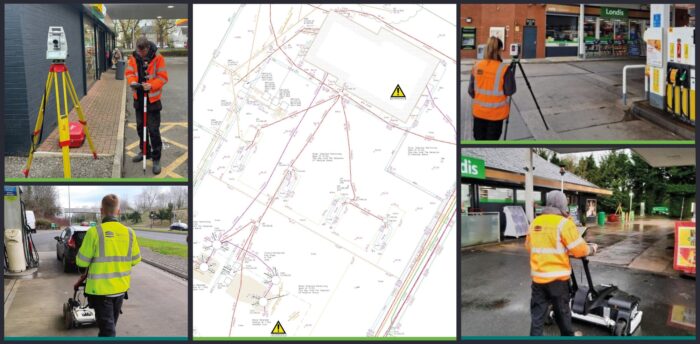
What Lies Beneath – Desktop utility reporting and the first step in safety

Utility strikes – The UK experiences over 60,000 each year, with consequences ranging from explosions to floods, to life-threatening injuries for onsite personnel. The financial implications of utility strikes are estimated to amount to over £2.4 billion each year. A simple side street or residential…
Technics Careers – Connor Charles
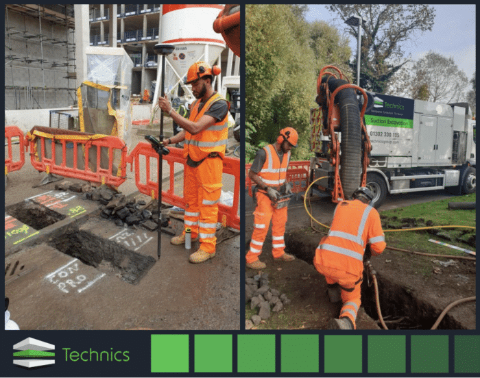
Technics has a reputable training programme which aligns with our culture of continuous improvement. We recently sat down with Connor Charles following his first 3 months of working with Technics. Connor joined Technics at the end of September 2023. His current role is as an assistant Vacuum Excavation…
Surging demand for electric vehicles fuels the need for more EV charging points nationwide
With the Government’s 2030 ban on new petrol and diesel car sales edging ever closer, it’s no surprise that there has been an increase in sales of electric vehicles. But as demand for electric vehicles continues to grow, so does the need for more electric…


