Topographic Surveys
Technics has over 35 years of experience producing accurate topographical surveys that inform decisions and minimise risk.
What is a Topographical Survey?
Topographical Surveys are used to identify and map the contours of the ground and existing features on the surface of the earth. This is beneficial for all industries such as the defence sector or energy sector.
Our surveys are used for a variety of purposes, including:
• As supporting data for a proposed housing development
• To inform architects and planners on the development of new builds and extensions
• To support a Land Registry Plan submission
• To inform engineering design
Our topographical surveys are carried out following the standards set by The Royal Institution of Chartered Surveyors (RICS),’ Measured surveys of land buildings and utilities,’ 3rd edition. Our teams receive a high level of training, to deliver efficiently and provide a cost-effective service on sites throughout the UK.
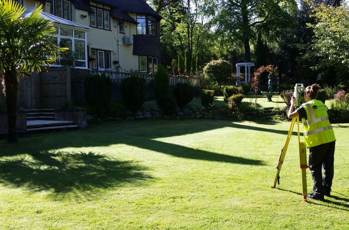
We use the latest Robotic and Reflectorless Total Station instruments to capture the site features; once collated, our Quality Assurance team checks and verifies every drawing before it is sent to the client. We have an excellent customer satisfaction rating for this service.

What information is included in a Topographical Survey?
A typical land survey will include the footprint of the existing buildings and structures, ground surfaces, boundary details, service covers, trees and drainage details. Additional details can be included, such as the features adjacent to the site or underground services. All our surveys include detailed level information.
For more information, please read our blog on topographical surveys and their purpose.
What type of surveys do we provide?
We can provide any type of survey, including:
• Level survey
• Rural and urban survey
• Road survey
• Volume survey
• Pipeline survey
• River survey
We are flexible in our delivery of data; the final drawing can be presented in the local grid or any existing grid provided by the client, or we can use our GPS/GNSS instruments to fix any survey to the National Grid and Ordnance Datum if required.
How is the Topographical Surveys data delivered?
A topographical survey project can be delivered in the following formats:
• 2D AutoCAD DWG, DXF, DWF
• 3D digital terrain model
• MicroStation
• Moss Genio
• PDF
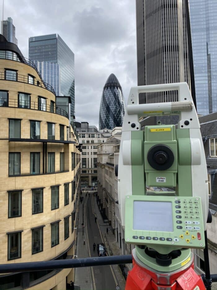
What equipment is used for a topographical survey?
- Leica robotic total stations
- GPS with post-processing
- Unmanned aerial vehicles
Technics utilise Leica robotic total stations for topographic surveys. With their powerful suite of on-board programs and many sensor and accuracy options, they provide the perfect tool for land surveying.
If you require your data to be fixed to the National Grid and Ordnance Datum, we can employ GPS with post-processing where necessary to achieve the required accuracy.
For larger projects, Technics is qualified to use Unmanned Aerial Vehicles (UAV) to capture varying data sets to enable extraction of the topographical features required specifically for your project.
How much does it cost?
Please contact us with the details of your site including the survey extents using an OS plan or similar. We can agree on the specification of works once the purpose of your survey has been discussed. Our quotation will itemise our fee, project programme and the deliverables.
To discuss your project with us, please call one of our offices and speak to one of our experts or email enquiries@technicsgroup.com


